


Monday April 10, 2023 | LANGFORD, BC [Updated 3:45 pm]
by Mary P Brooke | Island Social Trends
This year’s Tsunami Awareness Week runs April 9 to 15. It’s a great time to become familiar with available resources.
A tsunami is a natural hazard consisting of long, surge-like waves usually caused by an underwater earthquake, landslide or volcanic eruption that may last for hours. Since the largest wave may arrive much later than initial waves, it’s not safe to go back to coastal or low-lying areas until instructed.
The majority of the capital region’s coastline is quite elevated with a limited risk of tsunami. Low-lying shoreline areas might expect the greatest risk.
The National Tsunami Warning Centre detects tsunami threats using seismometers, tide gauges and DART (Deep-ocean Assessment and Reporting of Tsunamis) buoys.
If an earthquake is large enough, the national centre will issue a tsunami warning.
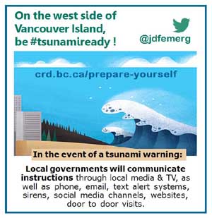
Local governments and the media will share this information with the community. Residents of Juan de Fuca may wish to follow @jdfemerg on Twitter.
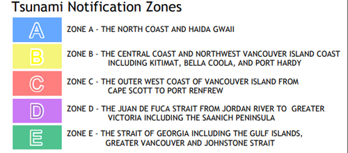
Five zones:
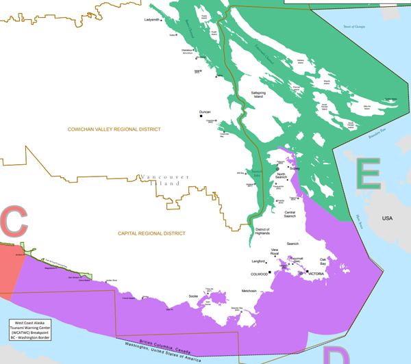
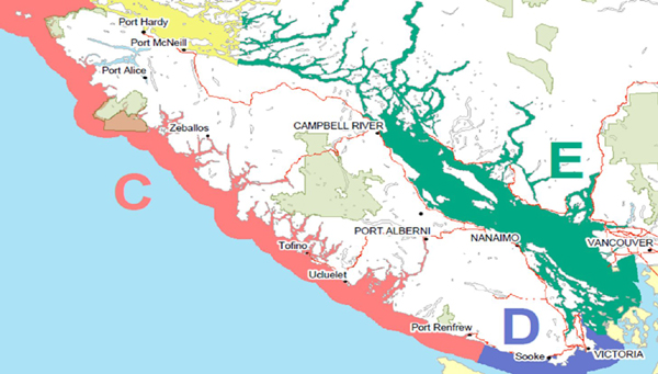
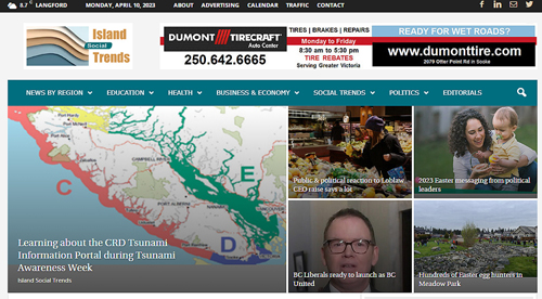
B.C.’s coast is divided into five (5) notification zones. Do you know your zone?
- Most residents along the Juan de Fuca Strait are in Zone D (including the Capital Regional District — notably Esquimalt, Sooke and in Juan de Fuca west of Sooke to around Jordan River, and in East Sooke). Here’s the list by municipality/First Nation: Beecher Bay, Central Saanich, Colwood, Esquimalt, Jordan River, Metchosin, North Saanich, Oak Bay, Saanich, Shirley, Sidney, Songhees, Sooke, Tsawout, T’Sou-ke, Victoria, View Royal.
- Port Renfrew is in Zone C.
- The eastern coast of Vancouver Island is in Zone E, including the Saanich Inlet as well as the Gulf Islands; includes Chemanius, Thetis Island and Kuper Island along the Georgia Strait; includes Duncan and Nanaimo.
Local & distant:
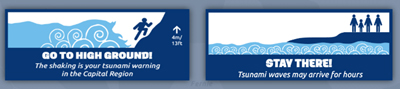
A local tsunami will be associated with a felt earthquake, and the shaking is your warning to move away from the tsunami hazard zone.
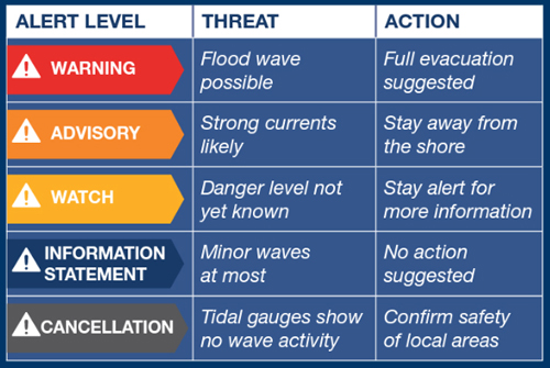
A distant tsunami may be associated with an earthquake far away that may not be felt, an undersea landslide or a volcanic eruption. It may take many hours for a distant tsunami to reach our coastline. Authorities will let you know if any action is necessary from a distant tsunami by issuing one of the following alerts: Warning, Advisory, Watch, Information Statement, or Cancellation.
What’s in the portal:
The CRD Tsunami Information Portal includes an interactive map for exploring your area and better, and to understand the tsunami hazard risk where you live, work and frequent. There is a function for mapping a safe route in the event of a tsunami warning.

How to use the portal:
Find tips on how to use the Tsunami Information Portal in the Tsunami Information Portal User Guide (PDF).
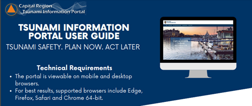
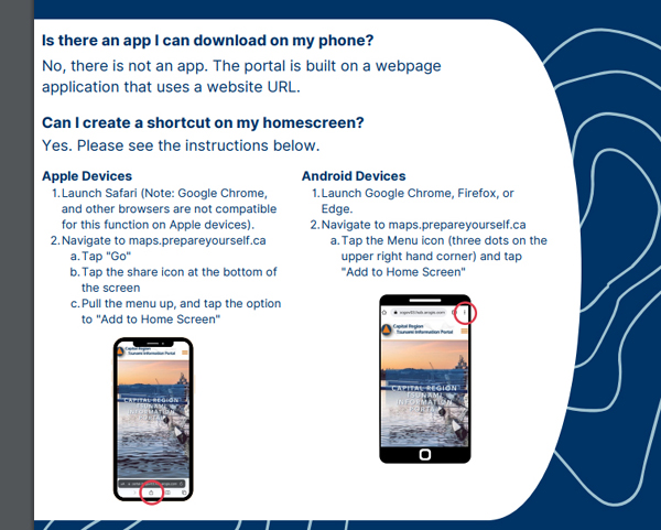
The portal is viewable on mobile and desktop browsers (you can create a shortcut to the Tsunami Information Portal). Learn how to find the “My Location” button on the map when you open it on a mobile device.
For best results, supported browsers include Edge, Firefox, Safari and Chrome 64-bit.
- Landing page provides access to mapping and information resources relating to tsunami preparedness in the capital region.
The clickable links in the header allow users to navigate the different sections: Home Page, Interactive Map, Tsunami Preparedness Information, Community Resources and the Prepare Yourself webpage. - Interactive map allows the user to explore and visualize place-based tsunami-related information.
- Tsunami preparedness information for Local and Distant Tsunami events.
- Community Resources. These clickable icons direct users to learn more about emergency preparedness in their local jurisdiction.
- Link to Prepare Yourself. Takes users to the Prepare Yourself website to learn about additional hazards and emergency preparedness in the Capital region.
High ground hikes:
During Tsunami Preparedness Week in BC many communities are holding High Ground Hike Events including in:
- Colwood
- Heiltsuk Nation (Bella Bella)
- Mount Waddington Regional District – Quatsino
- Old Massett
- Pacheedaht First Nation
- Piers Island (during Emergency Preparedness Week)
- Port Hardy
- Port Moody
- Prince Rupert
- Sooke
- Stewart
- Tahsis
- Tofino
- Toquaht Nation (Ucluelet)
- Ucluelet
- Victoria
==== ABOUT ISLAND SOCIAL TRENDS:

Island Social Trends is a long-standing publication in the west shore of South Vancouver Island (fourth in a series that began with print publications MapleLine Magazine 2008-2010, Sooke Voice News 2011-2013, and West Shore Voice News 2014-2020, which then emerged as Island Social Trends fully online in mid-2020).
IslandSocialTrends.ca covers news of the Greater Victoria area and south Vancouver Island, with insights on BC and national issues.
Island Social Trends editor is Mary P Brooke, B.Sc., Cert PR. She is a long-time journalist, delivering news through a socioeconomic lens, and now reports with the BC Legislative Press Gallery.
Island Social Trends continues to build the Island Social Trends Food Security Archive with articles about food security on south Vancouver Island and current developments around food sustainability across BC and nationally. Food security will be an issue in any major event like an earthquake or tsunami. Island Social Trends covers emergency preparedness news.