


Monday December 4, 2023 | VICTORIA, BC
by Mary P Brooke | Island Social Trends
The BC Government is encouraging people to prepare and be vigilant as several weather warnings have been issued for a storm that will bring heavy rain, strong winds and snow to some areas.
The storm will impact BC on Monday December 4, and should ease on Tuesday December 5.
In the south Vancouver Island area it’s been rainy steadily all day.
Rainfall warnings:
Environment and Climate Change Canada (ECCC) has issued rainfall warnings throughout Vancouver Island, Fraser Valley, Fraser Canyon, Howe Sound, Skagit Valley, Highway 3 Paulson Summit to Kootenay Pass, Elk Valley, Metro Vancouver and Whistler.
These areas are expected to receive significant rain, including up to 150 millimetres on parts of Vancouver Island, up to 100 mm in northern Metro Vancouver communities, up to 60 mm for the Fraser Canyon south of Lytton, and up to 70 mm in the Fraser Valley and the Coquihalla Highway (Hope to Merritt).
The Interior will also see impacts in the Kootenay region with up to 100 mm of rain on Highway 3 between the Paulson Summit and Kootenay Pass from Monday night until Thursday morning.
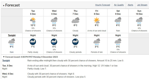
People are encouraged to check the ECCC weather page for updated alerts and forecast rainfall totals. | Greater Victoria Weather Forecast
The B.C. River Forecast Centre is closely monitoring forecasts and updating streamflow models, including effects of melting snow and rain-on-snow from warmer temperatures over the next few days. Advisories, watches and warnings will be issued when appropriate.
Flood watches are currently in place for the following areas:
- * South Coast, including the Sunshine Coast, Howe Sound, North Shore Mountains;
- * Lower Mainland including Metro Vancouver; and
- * Lower Fraser Valley, including up to Hope and the Coquihalla Summit, and neighbouring basins.
High streamflow advisories are currently in place for the following regions:
- * Vancouver Island;
- * Tulameen River and tributaries;
- * Coldwater River and tributaries of the Nicola River downstream from Merritt, including Spius Creek; and
- * West Kootenay, East Kootenay and Elk River near Fernie, including lower elevation and valley bottom tributaries.
Additionally, ECCC has issued wind warnings for the Central Coast, Haida Gwaii, North Coast and north Vancouver Island. Areas are expected to receive 90 km/h winds gusting to 120 km/h over exposed coastal locations on Monday afternoon.

Winter storm warning:
Several regions are under a winter storm warning, including Kootenay and Yoho National Park, Kinbasket, North Columbia and West Columbia. Each region is expected to receive 15 centimetres of snow accumulation changing to rain, accompanied with ice pellets, with the risk of freezing rain and possible slippery conditions.
The Province has deployed sandbags to 27 First Nations and local governments, and is prepared to take further actions to keep people and communities safe, such as:
* working closely with communities on preparedness activities, including regular regional co-ordination calls with First Nations and communities;
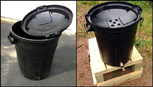
* preparing to deploy as many as four million sandbags to local governments to protect homes and public infrastructure; [Sandbags in Sooke]

* preparing to deploy or pre-position sandbag machines to areas of flood concern or potential flood concern throughout the province;
* preparing to deploy 10 kilometres of gabions, which are wall-like structures filled with sand, and 32 kilometres of tiger dams, which are stackable orange tubes filled with water;

* River Forecast Centre monitoring weather patterns and river conditions and remaining vigilant for shifts in rainfall intensity, duration or location that could contribute to an increased flood hazard; and
* issuing broadcast and wireless intrusive emergency alerts on behalf of communities to warn people about imminent threats due to flooding.
People are asked to take precautions to ensure personal safety, including developing a household plan, putting together emergency kits, connecting with neighbours and learning about the local government emergency response plan for their area.
Be prepared at home:
Protect your home:
People are advised to prepare for possible flooding of low-lying areas by moving equipment and other assets from these areas to higher ground, where possible. Clear perimeter drains, eavestroughs and gutters. Sandbags also help and can be made available through your local government.
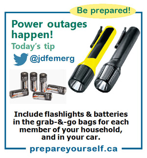
Create grab-and-go bags:
Assemble an individual grab-and-go bag for each member of the household with the essentials they will need if asked to evacuate.
Recognize the danger signs:
If you live near a waterway, a change in water colour or rapid change in water level, especially a drop, could indicate a problem upstream. Call your local fire, police or public works department immediately if you suspect something is out of the ordinary.
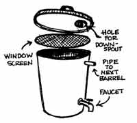
Set up your rainbarrels for water collection:
Collecting rainwater for use in the garden next spring is an economical way to use water. Take a moment to make sure your rain barrel system is set up.
Flood warning:
If you face a threatening flood situation, park vehicles away from streams and waterways, move electrical appliances to upper floors and make sure to anchor fuel supplies. Listen to local officials if you are asked to evacuate.
In the event of flooding, some tips about what to avoid:
Steer clear of river shorelines:
Keep away from river edges and shorelines. During periods of high flow, river banks may be unstable and more prone to sudden collapse. Stay away and keep young children and pets away from the banks of fast-flowing streams and flooded areas or bridges.
Do not drive through flood water:
Never attempt to drive or walk in flood water. Approximately 15 cm (six inches) of fast-moving water can knock over an adult, and 61 cm (two feet) of rushing water can carry away most vehicles, including SUVs and pickup trucks.

Landslide risk:
Heavy rain may contribute to landslides and dangerous debris in creeks and waterways. Be safe and do not go to watch the rushing water. If you notice trees beginning to lean or bend near your home, or cracks developing in the hillside, consult an engineer or contact local authorities.
There are more details in PreparedBC’s Flood Preparedness Guide. The guide contains useful information to help British Columbians better protect themselves and their homes and understand what to do if their home or community is at risk of flooding.

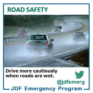
Driving safety:
Crashes can be prevented when motorists are prepared. Some helpful tips for travelling in wet weather and winter driving conditions:
- * Research the current road conditions before you leave at DriveBC’s webite. Nearly 900 highway webcam views are available at more than 450 locations throughout the province.
- * Check the weather forecast and consider postponing travel. If travel is necessary, wait until conditions improve.
- * Wear comfortable clothing that does not restrict movement while driving. Bring warm clothing, such as winter boots, coat, gloves and hat, in case you need to get out of the vehicle.
- * Have an emergency plan. Ensure your vehicle is equipped with a full tank of fuel, a windshield scraper and snow brush, food and water, a first-aid kit and other emergency supplies.
- * Do not panic if you get stuck or stranded. Stay with your vehicle for safety and warmth.
- * If you have a cellphone, call for roadside assistance. For emergencies, call 911.

===== GOVERNMENT LINKS:
Active evacuation alerts and orders, follow @emergencyinfoBC on X (formerly Twitter), or visit: https://www.emergencyinfobc.gov.bc.ca/
River Forecast Centre on the risk of flooding, visit: http://bcrfc.env.gov.bc.ca
Forecasts and alerts from Environment and Climate Change Canada, visit: http://www.weather.gc.ca
PreparedBC Flood Preparedness Guide, visit: https://www.preparedbc.ca/floods
How to prepare grab-and-go bags, visit: https://www.preparedbc.ca/emergencykit
Pre-register with Emergency Support Services, visit: https://ess.gov.bc.ca
Flood waters can quickly wash out roads and bridges. Be prepared and plan an alternative route. For the latest road conditions, visit: http://www.drivebc.ca