Wednesday November 20, 2024 | SOOKE, BC
by Mary P Brooke | Island Social Trends
Last night the impact of a ‘bomb cyclone’ storm with strong winds and rain was experienced in the Sooke region of south Vancouver Island.
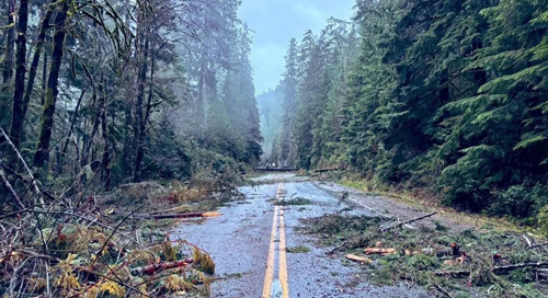
Mid-evening last night (Tuesday) the province advised about the closure of these highways, with Highway 14 being the most central to functionality of the Sooke region (it’s the one route in/out of Sooke):
- Highway 4 from Highway 4A (Errington) to Port Alberni, and from Port Alberni to Tofino/Ucluelet junction
- Highway 14 west of Sooke
- Highway 18 at Hillcrest
- Highway 28 from Gold River to Campbell River
- Pacific Marine Circle Route
This morning the District of Sooke said they are responding to the significant storm event that has caused widespread disruptions across the region.
Tree management:
Wind strength was beyond 100 km/hour which resulted in fallen trees, downed power lines and debris across highways which led to the road closure decision by the Ministry of Transportation and Transit.
Trees in forested areas are somewhat difficult to predict in terms of their response to wind, heat and rain. Debris on highways is just one of those things that must be dealt with after a big storm.
Essential travel only today on Highway 14:
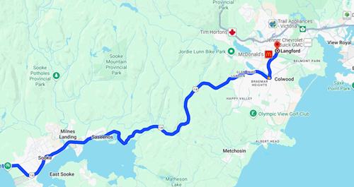
This morning November 20, Drive BC is recommending against non-essential travel on Highway 14 due to the significant amount of debris on the road surface. “Conditions are improving as crews safely perform cleanup and restoration work.
- Single-lane alternating traffic in several locations between Langford and Sooke. BC Hydro is on scene to guide alternating traffic with 30-minute stoppages.
- Highway 14 is closed at Kemp Lake Road in Otter Point; detour via Otter Point.
- East Sooke Road is closed just west of Gillespie Rd.
Highways closed lats night:
- Highway 4 from Highway 4A (Errington) to Port Alberni, and from Port Alberni to Tofino/Ucluelet junction
- Highway 14 west of Sooke
- Highway 18 at Hillcrest
- Highway 28 from Gold River to Campbell River
- Pacific Marine Circle Route

Power outages carry over to Nov 20:
Last night there were several power outages across the south Vancouver Island region, reaching nearly 60,000 BC Hydro customers without electricity at the peak of the storm’s impact.
As of 12:59 today (a bright sunny day), 22,505 BC Hydro customers on south Vancouver Island still remain without power — mostly in the Duncan area and Gulf Island; 2,699 of the customers without power are in the Metchosin and Sooke areas.
Check the BC HYDRO OUTAGE LIST for restoration times.
===== RELATED:
- Highways 4, 14, 18 & 28 closed due to coastal windstorm Nov 19 (November 19, 2024)
- Coastal windstorm warning for Nov 19 evening (November 19, 2024)
- NEWS SECTIONS: VANCOUVER ISLAND | DRIVE BC WEBCAMS


