


Friday January 12, 2024 | LANGFORD, BC [Updated January 13, 2024 – 3 pm]
by Mary P Brooke | Island Social Trends
Weather forecasting for this Arctic cold spell has been fairly accurate.
Few people were caught off guard as to the fact it would be cold. Though it seems there was still some risk-taking with not having proper winter tires on vehicles. Snowfall was very light in Greater Victoria last night, but apparently black ice was a problem on some roads.
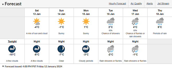
Arctic air arrived on Thursday and kept things pretty chilly today. In fact, many temperature records were broken. Tonight the wind will be northeast 30 km/h gusting to 50. Low minus 10. Wind chill near minus 20.
Flurries next week:
Environment Canada’s Victoria statement still includes an Arctic Outflow Warning saying the “first Arctic intrusion of the year” will last into Saturday afternoon.
Night time temperatures will still be below 0°C on Tuesday and Wednesday of next week (January 16 and 17) leading to snow flurries in the nighttime forecast.
Rain is back by Thursday, with a forecasted high of 6°C.
Power outages:
There were a lot of power outages on Tuesday January 9 on south Vancouver Island due to winds and heavy rainfall. Most of those were in coastal areas with heavily forested areas.
There were just a few power outages this morning, mostly in the Nanaimo area. Tonight there are no power outages on South Vancouver Island.

Power usage:
Apparently the electricity usage was 10,300 MW last night (January 11, 2024) at its highest point as people use various appliances and equipment for heat. As well, people are staying indoors more during cold weather and likely using more indoor electrical appliances including electronics.
“We expect demand will peak this evening (Friday January 12) and remain high over the next few days,” says BC Hydro media rep Mora Scott.
But the January 11 usage wasn’t as high as seen in some colder stretches of weather in 2020, 2021 and 2022.
- In December 2022 a new winter usage record was set at 10,977 MW, says BC Hydro. That was during the cold winter weather with snowfall Dec 19 to 21 in 2022 and cold weather lasting to December 23 and beyond.
- Back on December 27, 2021 a peak was set between 5 and 6 pm when demand for electricity hit what was then an all-time high of 10,902 MW.
- In 2020 there was a peak usage of 10,577 MW (on January 14, 2020 at 6 pm) which broke the previous records of 10,302 MW set on January 13, 2020 and 10,194 MW set on January 3, 2017.
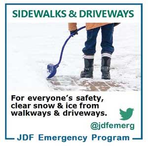
Winter safety preparation:
Winter safety preparation advisories have been issued by various levels of government, including by Provincial Health Officer Dr Bonnie Henry during her first media session of 2024 on January 10 — which was otherwise about the 2023-2024 respiratory illness season.

Environment Canada’s Victoria statement included an Arctic Outflow Warning earlier today, including that Arctic air combined with strong outflow winds gusting up to 60 km/h will generate wind chill values of minus 20 beginning tonight.
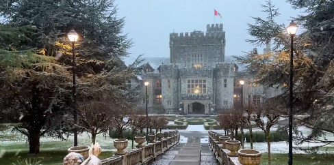
Snow began falling in the Greater Victoria area around 3 pm this afternoon. By evening there is already of light blanket of the white fluffy stuff on the ground around the region.
Wind chill:
We don’t often hear about a wind chill factor in the Greater Victoria as temperatures have traditionally been mild in winter.
Overnight last night the temperature fell to -10°C and is forecast as the same for tonight January 12 into Saturday January 13.
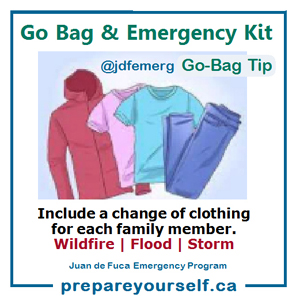
Layers for safety:
In cold weather it’s best to dress in layers. The outer layer should be wind-resistant, says Jeri Grant of the Juan de Fuca Emergency Program.
Synthetic and wool fabrics provide good insulating properties.
Frostbite can develop within minutes on exposed skin, especially with a significantly low wind chill.
===== RELATED:
- Quiet snowfall leads to some closures (January 17, 2024)
- Arctic air brings snowfall to Greater Victoria (January 11, 2024)
- Jan 2024 respiratory season update emphasizes vaccination (January 10, 2024)
- South Vancouver Island power outages Jan 9 (January 9, 2024)
- BC Hydro peak winter usage on snowy Dec 27 (December 28, 2021)