

Tuesday January 14, 2020 ~ LANGFORD [Updated at 10:15 pm]
~ West Shore Voice News
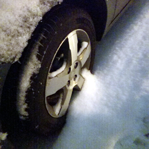
Environment Canada has issued a snowfall warning for West Vancouver Island. Snowfall with total amounts of 10 to 20 cm is expected in the Greater Victoria area overnight.
“A low pressure centre is forecast to approach Vancouver Island tonight. Snow will begin this evening and intensify during the night,” says Environment Canada. Snowfall amounts of 10 to 30 cm are expected over southern Vancouver Island by Wednesday morning (up to 20 cm in Greater Victoria and up to 30 cm on the east side of the island).
The snow will ease on Wednesday morning.
Rapidly accumulating snow could make travel difficult over some locations. Surfaces such as highways, roads, walkways and parking lots may become difficult to navigate due to accumulating snow.
Please continue to monitor alerts and forecasts issued by Environment Canada. To report severe weather, send an email to BCstorm@canada.ca or tweet reports using #BCStorm .
==== MORE ABOUT SNOW THIS WEEK (from Environment Canada):
Outflow winds through mainland coastal inlets and valleys will continue to drive cold arctic air into the Georgia Basin through much of the week. Additionally over the next few days, a series of pacific disturbances will combine with the cold airmass to produce several rounds of snow.

Early this morning, an initial weak system will produce some flurries near the Straight of Georgia and the Juan de Fuca Strait. Converging winds at low levels could produce local accumulations of a few cm’s.
A second more organized system will move in tonight and take aim at extreme southern Vancouver Island. Snowfall warnings have been issued for Greater Victoria, The Malahat, Gulf Islands, southern inland Vancouver Island (Lake Cowichan), East Vancouver Island from Duncan to Nanaimo, and for Port Renfrew on west Vancouver Island. 10 to 15 cm of accumulation is expected by Wednesday morning. Heavy snow from this system will likely move up the Island to Parksville-Qualicum and Courtney-Comox during the day Wednesday.
The Lower Mainland and Fraser Valley will also see snow tonight with amounts of 5 to 10 cm expected by Wednesday morning and an additional few cm’s during the day Wednesday.
A third system, associated with a deep offshore low, is on the horizon for Wednesday night. A fair degree of uncertainty exists regarding its impact upon the south coast. The mainland coast may suffer a glancing blow however Vancouver Island may see a considerable amount of snow as outflow winds increase with the passage of this system.