

Saturday January 15, 2022 | LANGFORD, BC [Last updated 11:11 am]
by Mary P Brooke | Island Social Trends
Early this morning the National Tsunami Warning Centre issued a tsunami advisory to the Juan de Fuca Straight coast due to a volcanic eruption in the Tonga Islands.
That has led to a Tsunami Advisory for the north coast and Haida Gwaii, the central coast and northeast Vancouver Island, the outer west coast of Vancouver Island, the Juan de Fuca Strait coast. Hawaii currently reported to be experiencing 30cm tsunami waves.
Wave activity was forecast for Langara about 8:30 am and Tofino about 8:50 am, EmergencyInfoBC said.
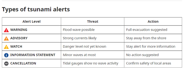
Advisory only:
It’s an *advisory* only. For most of the inland west shore area within Langford won’t have direct impact as much of the area is away from direct access to the ocean. But yes, if you’re out and about, or know anyone who might be directly affected, this is a heads up.
Today around 10 am, Public Safety Minister Mike Farnworth said: “Overnight, several communities along the coast activated their emergency plans.” He adds that Emergency Management BC (EMBC) is supporting local governments and First Nations with updates and a series of coordination calls.
“Although this is not a tsunami warning, this event demonstrates that coast warning systems do work,” said Farnworth in a statement today. He reminds people to *not* call 911 unless a life is at stake.
Municipal actions:
In consultation with EMBC, the City of Colwood says it will be closing beaches as a precautionary measure. The gates at either end of Ocean Blvd along the Lagoon will be closed this morning. NO evacuation of any homes is recommended.
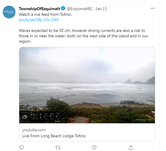
The Township of Esquimalt posted a live video feed of the waves rolling in at Tofino.
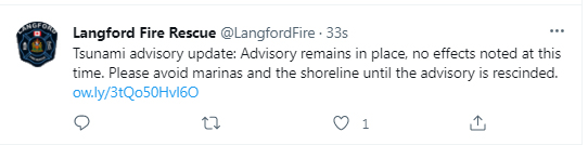
Langford Fire Rescue put out notices on Twitter.
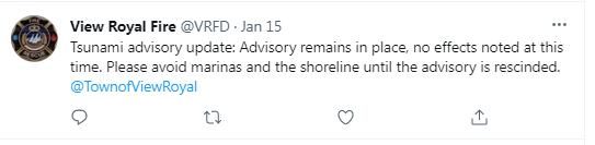
The Town of View Royal posted updates on Twitter.
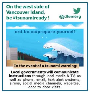
The Juan de Fuca Emergency Program will continue to monitor the situation for Port Renfrew, Jordan River and Sooke until the all clear is issued by EMBC, it was posted by JdFEmerg on Twitter around 10:40 am.
Don’t go near the water:
The Capital Regional District (CRD) reminds people to not go near the water. “If you are on or near the water, move out of the water, off the beach and away from harbours, marinas, breakwaters, bays and inlets,” says CRD.
EMBC advises people to not go to the shore to watch and to stay out of the water. For boat operators, if practical, move out to sea to a depth of at least 180 feet. If you’re already at sea, avoid entering shallow water, harbours and inlets.
The advisory is expected to be in place for five to six hours. The advisory to stay away from the water should be noted until the ‘all clear’ announcement has been made.
Get prepared for a tsunami:
Emergency Management BC (EMBC) has information on how to prepare for a tsunami.
Get the alerts:
To sign up for the CRD Public Alert Notification System (PANS) to receive alerts with emergency information in your community.
In the west shore area (Langford, Colwood, Sooke, View Royal) there is a West Shore Alert system, which is run through the CRD PANS system.
PANS is available to residents living in CRD Electoral Areas:
- Salt Spring Island
- Juan de Fuca (East Sooke, Otter Point, Shirley, Jordan River, Port Renfrew, Malahat, and Willis Point)
- Southern Gulf Islands (Pender Island, Galiano Island, Mayne Island, Saturna Island, Piers Island, Sidney Island, and smaller islands)
Residents should download the Alertable app or visit Alertable.ca to receive advisories such as, weather warnings, boil water advisories, or road safety information not sent by email, text or phone call.
EMBC says that for Tsunami alerting across BC, you’ll receive a notification on a compatible mobile device if a Tsunami Warning is issued. The Alert Ready system is not used for Tsunami Advisories where the risk is limited to increased tidal currents.
If you’re near the coast:

Emergency Management BC (EMBC) says about tsunamis:
“If you feel an earthquake, and you’re at the coast in an area without evacuation maps, plans or cell service, immediately move to at least 20 metres above sea level.”
EMBC advises that if you live in an at-risk community with evacuation plans:
- Move to high ground following your designated tsunami evacuation route
- Follow all instructions from local officials
- Stay on higher ground until you receive the “all clear” message from your local authority, tsunami waves can last several hours
- Never go to the beach to watch the waves. A tsunami can move faster than you can run

===== LINKS: