Sunday February 2, 2020 ~ VANCOUVER ISLAND
~ West Shore Voice News
On the west shore today it’s only partly cloudy on what feels like the first sunny day in a while after many days of rain and Friday night’s windstorm.
However, flooding and road debris are the continuing cleanup efforts from all this weather interruption.
As for traffic impacts on provincial highways and adjoining roadways:
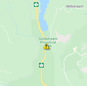
- Yesterday (Saturday February 1) the lower end of Finlayson Arm Road was flooded and not passable after Friday night’s rain. Vehicles cannot come up Finlayson Arm Road from the Trans Canada Highway (Highway 1). Residents on Finlayson Arm road must exit via Millstream Road. This is still in effect on Sunday at noon. Highway 1 is experiencing single-lane alternating traffic in both directions as part of dealing with a tree on the road at Finlayson Arm Rd by Goldstream Provincial Park.

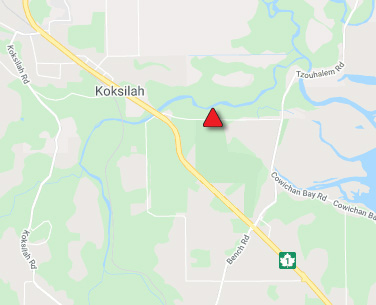
- Also still occuring today (as of noon), Cowichan Bay Road is closed in both directions until further notice due to flooding between Tzouhalem Road and Cowichan Bay Road and Highway 1. Tzouhalem Rd is also closed until further notice due to flooding. Next update time Sun Feb 2 at 6:00 PM PST.
- On the mainland at Agassiz, Hemlock Valley Road is closed in both directions due a mudslide and washout that occurred last night after heavy rainfall (120mm to 140mm). There is no detour at this time. This is the only road available to travel to and from the Hemlock Valley community and Sasquatch Mountain Resort in Agassiz. Approximately 1 km of road has been washed out.
- Meanwhile at Harrison Hot Springs, Rockwell Drive between Dogwood Lane and Rockwell Lane is closed in both directions due a washout that occurred last night after heavy rainfall (120mm to 140mm). There is no detour at this time. Rockwell Drive is accessible until Green Point, but is otherwise washed out due to torrential rains and flooding. There is also debris on the road.
Updates anytime at Drive BC.


