


Wednesday December 10, 2025 | VANCOUVER, BC [Posted at 10:31 pm PT]
by Mary P Brooke | Island Social Trends
The Ministry of Transportation and Transit has closed major highways between the Lower Mainland and the Interior due to flooding, falling rock and debris, and high avalanche hazards.
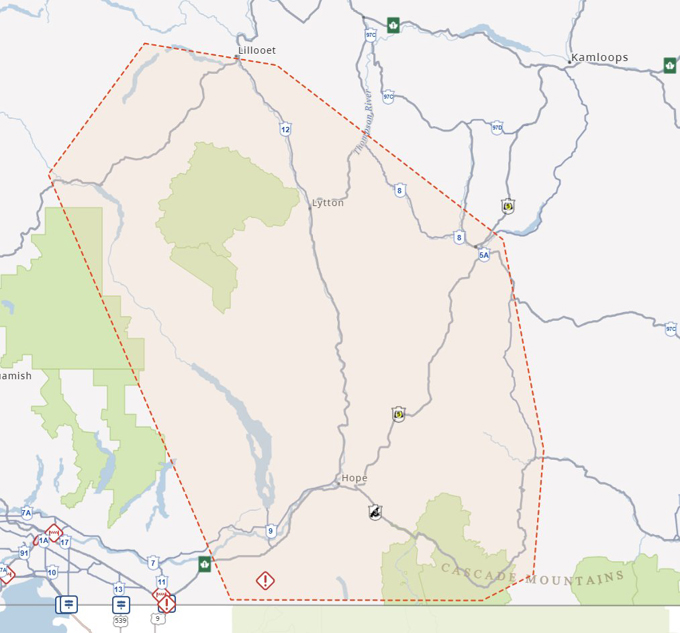
As of this evening Wednesday, December 10 the following highways are closed:
- Highway 1 eastbound closed at Bridal Falls / Highway 9 – significant amount of water crossing Hwy 1
- Highway 1 closed between Hope and Lytton
- Highway 3 closed between Hope and Princeton
- Highway 5 (Coquihalla) closed between Hope and Merritt / due to flooding
- Highway 7 is closed west of Hope (between Highway 9 and Ross Road) / small rockfall later in the day
- Highway 11 at the Sumas border crossing is closed to commercial traffic, open to local traffic only
- Highway 99 is closed between Pemberton/Lillooet and Mt. Currie
There is no timeline given for reopening, the Ministry said this evening in their news release at 9:16 pm PT.

The Nooksack River flows will peak at 10 pm this evening, holding to about 4 to 6 am on Thursday morning before beginning to recede.
Drivers are cautioned that other provincial roadways could be closed with little or no notice. Drivers are advised to travel only if necessary. For updates, visit DriveBC.
Ministry staff and maintenance contractors continue to patrol highways to identify areas of concern.

Contractors are on standby to clear debris and reopen highways as soon as it is safe to do so.
Evening media update by Minister Greene:
Earlier today Kelly Greene, Minister of Emergency Preparedness and Climate Readiness held a press conference about significant rainfall that could lead to flooding.
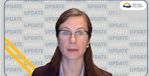
Then this evening, Minister Greene held a press conference at 8:30 pm with an update about the highway closure between the Lower Mainland and the Fraser Valley area.
Evacuation alerts and orders can be found at EmergencyInfoBC.ca and in social media on X at @EmergencyInfoBC. She reminds people to stay off the roads and not take any unnecessary trips.
On this evening’s call, Minister Green was supported by Connie Chapman, Executive Director, Water Management, Ministry of Water, Land and Resource Stewardship; Kevin Dunbar, Executive Director of Provincial and Regional Response, Ministry of Emergency Management and Climate Readiness; and Janelle Staite, Executive Director, South Coast Region, Ministry of Transportation and Transit.
The Ministry of Agriculture is working on this situation as well, given the number of farms in the Fraser Valley area with crops and animals.

===== RELATED:
Flood risk update with BC Minister of Emergency Management (December 10, 2025)
NEWS SECTIONS: EMERGENCY PREPAREDNESS | TRAFFIC | WEATHER IMPACTS