


Friday August 2, 2024 | CARIBOO REGION, BC
by Mary P Brooke | Island Social Trends
[See August 3, 2024 Chilcotin landslide update]
On this Friday afternoon, government officials provided a media update about the Chilcotin River landslide situation in the Cariboo region of the BC interior.
“Whatever we do has to safe and can’t make things worse,”says Bowinn Ma, Minister of Emergency Management and Climate Readiness.

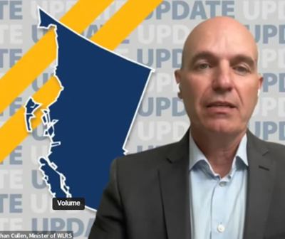
Minister of Water, Land and Resource Stewardship, Nathan Cullen, said the landslide that Nathan Cullen is about 30 m deep x 1,000 long and 600 m wide “is enormous in terms of its scale” including the lake pooling behind it.
While they do have data and projections, they’ve essentially got their fingers crossed that nature will take a gentle path through this potential crisis but are preparing for structural and community response including possible evacuation.
Yesterday Minister Ma said: “In the event of the dam collapsing, an outburst of water would flow down the Chilcotin River and into the Fraser River, bringing with it a significant amount of debris. Water levels could increase extremely quickly along the Chilcotin River, as well as in the Fraser River immediately below the confluence to Hope.”
Cause of the landslide:
The cause of the landslide is not open for active public discussion right now, said Ma today in a 1 pm press conference. There is some question as to whether commercial logging activity led to the problem.
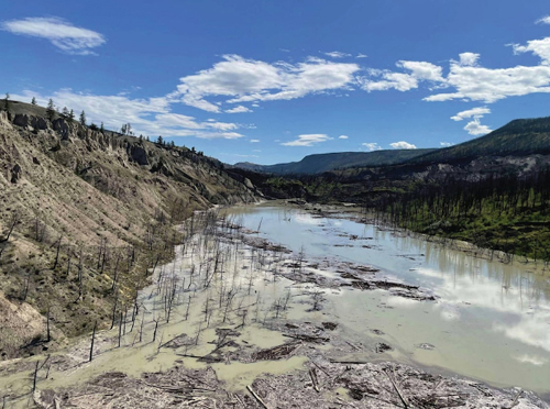
The danger is about unpredictable water flow. The slide is said to have happened in the middle of the night sometime between July 30-31. An intense thunderstorm over Williams Lake Monday night, July 29 brought with it nearly cm of rain in a short period of time.
“Slow seepage over the top or something more significant,” is how Cullen described the possible flooding potential. “This slide is particularly large.”

Cullen talked about terminal temperatures for salmon as well as stream flow to help mitigate any salmon challenges through the system.
How it happened:
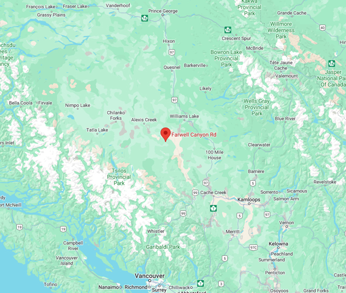
The Chilcotin dam is near Farwell Canyon, about 285 kilometres north of Vancouver, in the Cariboo region of the BC interior.
The landslide blocked the Chilcotin River, which feeds into the Fraser River. The landslide is approximately 22 kilometres upstream from the Farwell Canyon Bridge
They are preparing for potential flooding in the area. They are “dependent on how nature runs its course if it is left without intervention” including the debris flow component.
In 2017 this area was hit hard by wildfires which may have sensitized the area to the impact of water.

On-site data:
On-site data is being received every 12 to 15 minutes. There will be “a number of hours available to us to notify the public of any impending impacts”.
Flooding is anticipated in low level areas but evacuations are not necessarily yet required, said one official during the media briefing.
Emergency preparedness:
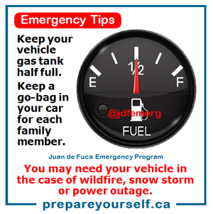
Minister Ma reminds all British Columbians to be prepared for any emergency that might present itself. The basics includes having a go-bag prepared for each member of the household or workplace.
The BC long weekend is coming up now through Monday August 5. People will be on the roads travelling or enjoying the outdoors in many areas of the province.
Cariboo region:
The Cariboo region is between the Cariboo Mountains to the east and reaches west across the Fraser River plateau to the Coast Mountains. Major cities in the Cariboo region include 100 Mile House, Williams Lake and Quesnel.

===== RELATED NEWS SECTIONS: